
Whistler and North Shore ski hills could be get up to 50cm
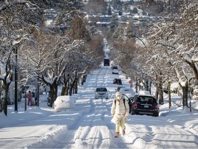
Wednesday morning will be “an absolute mess” across much of the Lower Mainland as a moisture-laden low pressure system meets an arctic high, bringing up to 25 cm of snow over a 12-hour period with high winds, says a Weather Network meteorologist.
Tyler Hamilton said he has been tracking a low pressure system off the north of Vancouver Island and expects it to begin bringing clouds to the Lower Mainland early on Tuesday afternoon as the system moves east.
Start your day with a roundup of B.C.-focused news and opinion delivered straight to your inbox at 7 a.m., Monday to Friday.
Thanks for signing up!
A welcome email is on its way. If you don't see it, please check your junk folder.
The next issue of Sunrise presented by Vancouver Sun will soon be in your inbox.
By Tuesday evening, as the low starts to make contact with the arctic high pressure system in the Interior of B.C., snow will start to fall – accumulating at a rate of two to four centimetres an hour, and keep coming down until around dawn on Wednesday.
Hamilton said areas south of the Fraser River – like Delta and White Rock – will be spared the brunt of the impact and see around 10 cm of snow.
However, North Vancouver, Burnaby, Coquitlam and East Vancouver would likely see between 20 and 25 cm, while the North Shore mountains could get up to 50 cm of snow. Whistler is also expected to get a massive dump.
“It’s a very, very favourable set up for the ski hills at high elevation,” Hamilton said.
“For the Lower Mainland though it’s going to be an absolute mess, with winds of 60 to 70 kilometres an hour coming with the snow.”
Temperatures are expected to rise above freezing on Wednesday, so there will be a lot of slush that is likely to lead to power outages.
Temperatures will cool again on Thursday, with some light rain or flurries expected.
Hamilton is forecasting another snow event on Friday, that could also be significant.
“It’s not a one and done,” he said. “We likely going to see a couple of snowfall events this week.”
High mountain passes in B.C’s southern interior are also expected to see heavy snow, making for treacherous driving conditions.
Environment Canada has issued a special weather statement warning of the coming snowfall and also warning of freezing rain in the Fraser Valley on Wednesday morning as incoming warm air overrides cold outflows.
There was a 20 cm snowfall event in Vancouver on Dec. 20, 2021.
Here’s a look at some of the preparations being made for the snowfall:
Public Transit
TransLink is calling in extra staff, co-ordinating with municipalities and preparing special trucks to spread anti-icing solution on trolley wires.
Articulated buses will also be replaced with conventional 40-foot buses to better handle steep and slippery sections of road while Millennium Line trains will be coupled into four-car configurations to increase capacity.
A UBC snow shuttle is expected to be established to UBC from Alma Street.
Schools
School boards across Metro Vancouver have different parameters for what constitutes a snow day. Parents and caregivers can expect to be notified early Wednesday morning whether a decision had been made to close for there day. Usually there will be staff at the school even if closed in case some kids get dropped off.
Warming Centres
All major municipalities have warming centres available for people who are homeless or have insecure housing.
The City of Vancouver has made extra beds available, as per a posting on Twitter. It has eight sites available.
