


Atlantic Churns: Isaac Intensifies to Hurricane, Joyce Emerges as Tropical Storm
Hurricane Isaac forms in the Atlantic, potentially affecting the Azores. Tropical Storm Joyce develops, while Hurricane Helene impacts Florida. No immediate coastal warnings issued for Isaac or Joyce.
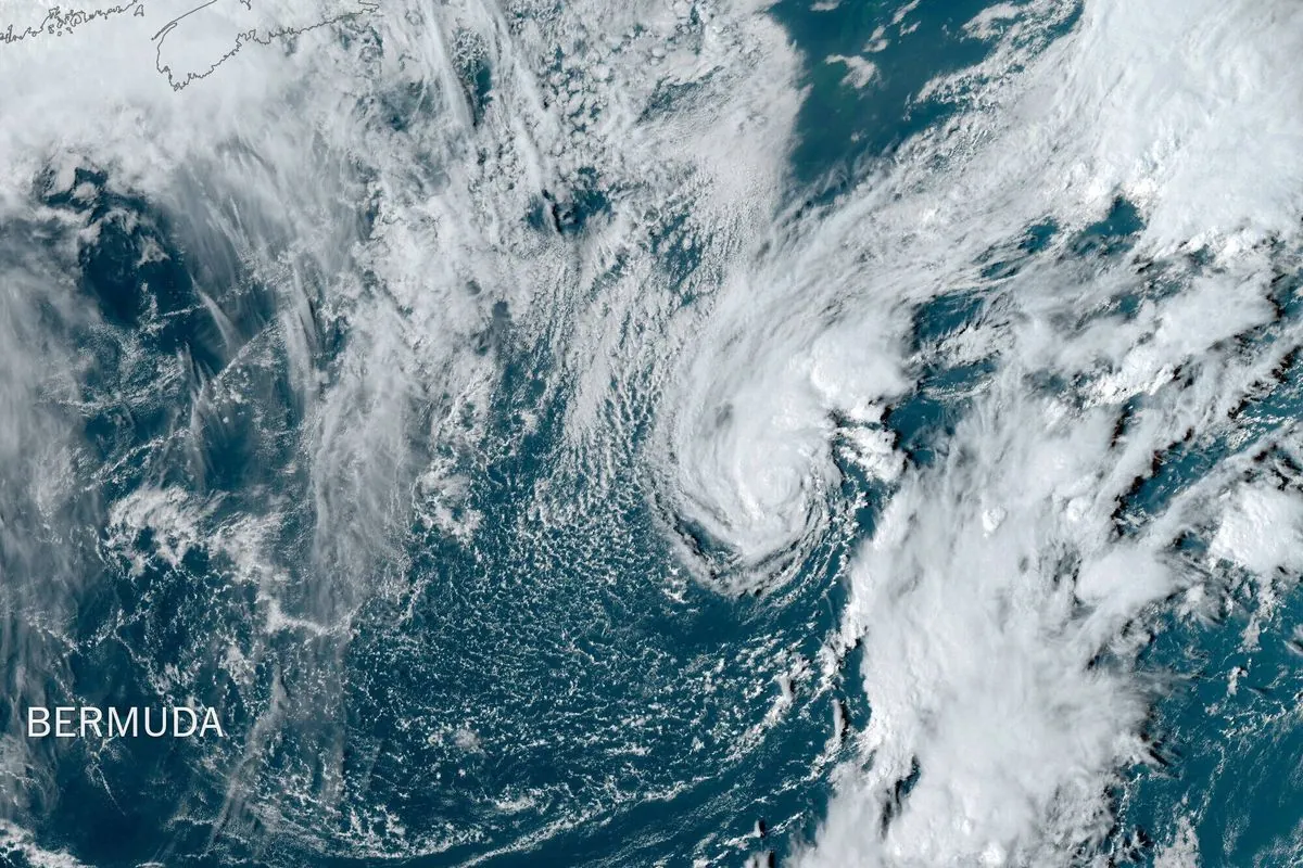
On September 26, 2024, the Atlantic Ocean witnessed significant meteorological activity as Isaac intensified into a hurricane and Tropical Storm Joyce formed. These developments occurred just as Hurricane Helene made landfall in northwestern Florida, causing flooding and power outages.
Hurricane Isaac, located approximately 1,080 miles (1,740 kilometers) west of the Azores, boasted maximum sustained winds of 75 mph (121 kph). Moving east-northeast at 18 mph (29 kph), Isaac posed no immediate threat to land. However, forecasters cautioned that the storm could generate life-threatening surf and rip current conditions in the Azores archipelago.
The U.S. National Hurricane Center (NHC) in Miami, responsible for tracking and predicting tropical cyclones in the Atlantic basin, reported that Isaac was expected to strengthen before gradually weakening by the end of the weekend. This pattern aligns with the typical lifecycle of hurricanes, which can persist for several days or even weeks over open waters.
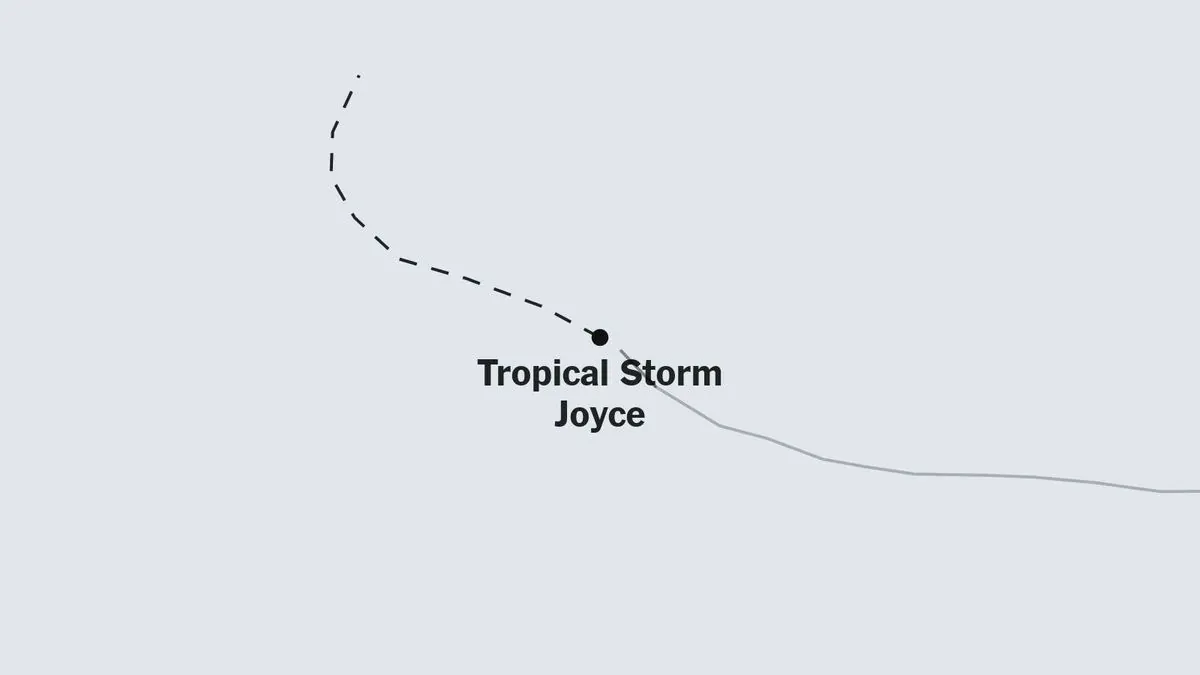
Simultaneously, Tropical Storm Joyce emerged about 1,325 miles (2,130 km) east of the northern Leeward Islands. With maximum sustained winds of 40 mph (65 kph) and moving northwest at 13 mph (20 kph), Joyce was anticipated to strengthen gradually through Sunday before weakening early the following week.
It's worth noting that the Atlantic hurricane season, which officially runs from June 1 to November 30, has been particularly active this year. The formation of Isaac and Joyce underscores the importance of hurricane preparedness, including having emergency kits and evacuation plans in place for coastal residents.
While no coastal watches or warnings were in effect for either Isaac or Joyce, meteorologists continue to monitor their progress closely. The NHC utilizes advanced technologies such as Doppler radar and data from hurricane hunter aircraft to assess the structure and intensity of these storms accurately.
As climate change is expected to increase the intensity of tropical cyclones over time, the scientific community remains vigilant in studying these powerful weather phenomena. The Saffir-Simpson Hurricane Wind Scale, which classifies hurricanes from Category 1 to 5, helps communicate the potential impact of these storms to the public.
The recent events in the Atlantic serve as a reminder of the complex interplay of factors involved in tropical cyclone formation and development. From the Coriolis effect causing counterclockwise rotation in the Northern Hemisphere to the necessity of sea surface temperatures of at least 26.5°C (79.7°F) for cyclogenesis, each storm tells a unique story of atmospheric and oceanic conditions.
As the 2024 Atlantic hurricane season progresses, coastal communities from the Azores to the Leeward Islands and beyond remain on alert, ready to respond to the ever-changing dynamics of these powerful storms.