Deadly Floods Ravage Northeast India and Eastern Bangladesh
Severe flooding in India's Tripura state and eastern Bangladesh has resulted in at least 15 deaths and displaced thousands. Rescue efforts are hampered by communication challenges and rising water levels.
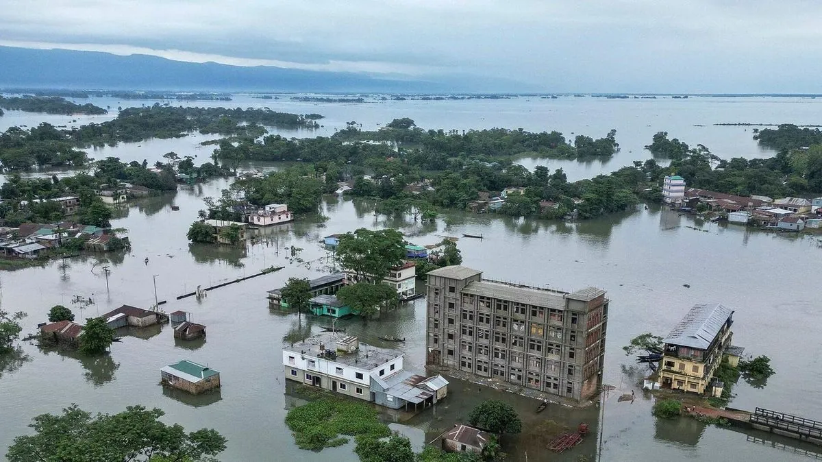
Severe flooding has struck India's northeastern state of Tripura and neighboring eastern Bangladesh, resulting in at least 15 fatalities and forcing hundreds of thousands to evacuate their homes. The disaster, which began on 2024-08-19, has overwhelmed rescue efforts in both countries.
In Tripura, one of India's smallest states that gained full statehood in 1972, at least 11 people have lost their lives due to the floods and mudslides. The state's capital, Agartala, known as India's third international internet gateway, was among the severely affected areas. Tripura's Chief Minister Manik Saha stated, "We are closely monitoring the situation and are focusing on providing relief to those displaced from their homes." Authorities have established over 300 relief camps to accommodate the thousands of displaced residents.
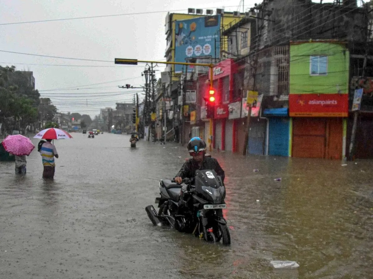
The India Meteorological Department, one of the world's oldest weather services established in 1875, issued a "red" alert for Tripura on 2024-08-20. This prompted officials to announce a two-day school closure across the state.
In Bangladesh, one of the world's most densely populated and flood-prone countries, four deaths have been reported. The victims included a pregnant woman who fell into turbulent waters in Akhaura, Brahmanbaria district. The flooding has severely impacted eastern Bangladesh, particularly in the districts of Cumilla, Feni, and Noakhali.
Sonia Akter, a mother stranded in Feni, described the dire situation: "We are taken shelter at a house where about 35 people need to be rescued soon. The water is still rising and now we are on the rooftop with our small kids and elderly family members. Please send us a boat. Please save us."
Rescue operations in both countries face significant challenges due to power outages and severed communication links. The Bangladesh Flood Forecasting and Warning Center, established in 1972, reported that water levels in many rivers across the country's eastern, northeastern, and southeastern regions continue to rise.
This disaster highlights the vulnerability of the region to monsoon floods, which typically occur from June to September. India and Bangladesh share 54 common rivers flowing from the Himalayas to the Bay of Bengal, forming part of the Ganges-Brahmaputra Delta, the world's largest. The Indo-Bangladesh border, the fifth-longest land border globally, often complicates water management issues between the two nations.
Some Bangladeshi citizens have accused India of exacerbating the floods by opening a dam in Tripura, a claim that India's Ministry of External Affairs has denied. This controversy underscores the ongoing challenges in water sharing between the two countries.
As climate change is expected to increase the frequency and intensity of floods in the region, which affects about 60% of the world's population, improved cooperation and disaster preparedness between India and Bangladesh will be crucial for mitigating future catastrophes.


