
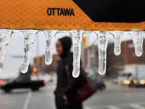
Freezing rain featuring a few millimetres of ice buildup may be part of a “wintry mix” of precipitation starting Thursday afternoon.
It could start as snow before switching to ice pellets and freezing rain, Environment and Climate Change Canada said in a special weather statement for Ottawa issued Wednesday morning. The messy mix is expected turn into rain in most areas by Thursday night.
Sign up to receive daily headline news from Ottawa Citizen, a division of Postmedia Network Inc.
Thanks for signing up!
A welcome email is on its way. If you don't see it, please check your junk folder.
The next issue of Ottawa Citizen Headline News will soon be in your inbox.
“A prolonged period of freezing rain is expected and freezing rain warnings may be required as the event draws nearer,” Environment and Climate Change Canada said.
“Travel conditions may become hazardous due to icy and slippery roads and walkways.”
As of Wednesday morning, the day’s forecast is mainly cloudy with a high of 3 C. Wind was expected to become west at 20 km/h gusting to 40 in the morning then drop off in the afternoon.
Skies are expected to clear late Wednesday evening on the way to a low of -7 C with fog patches developing overnight and a wind chill of -12 Thursday morning.
Thursday’s forecast is increasingly cloudy with ice pellets or snow mixed with freezing rain beginning in the afternoon and a high of 0 C.
Periods of rain and a low of 2 C are on tap for Thursday night.
Friday is expected to reach 4 C with a 40 per cent chance of flurries or rain showers then dip to -7 C overnight.
“Normals” for this time of year are highs of -5 C and lows of -14 C.
