Dual Storms Threaten Mexico and Southeast U.S. as Hurricane Season Intensifies
Two major weather systems are impacting Mexico's coasts, with Tropical Storm John causing fatalities and a potential hurricane forming in the Caribbean. Florida declares a state of emergency as preparations begin.
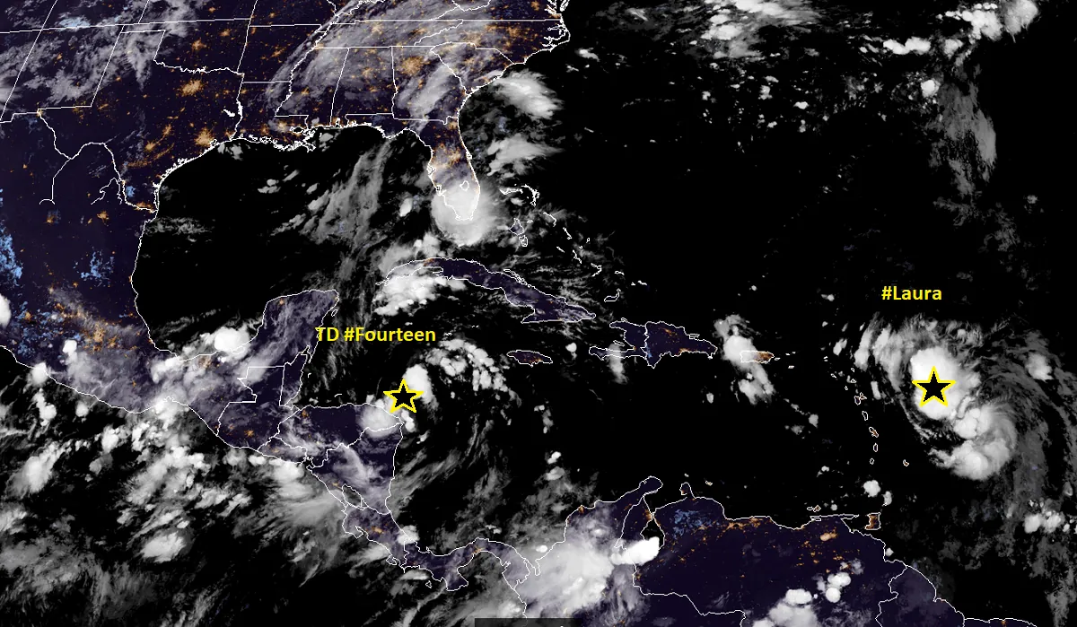
As the Atlantic hurricane season reaches its peak, two significant weather systems are currently affecting Mexico's coasts and threatening the southeastern United States. This development comes as a stark reminder that the hurricane season, which officially runs from June 1 to November 30, is in full swing.
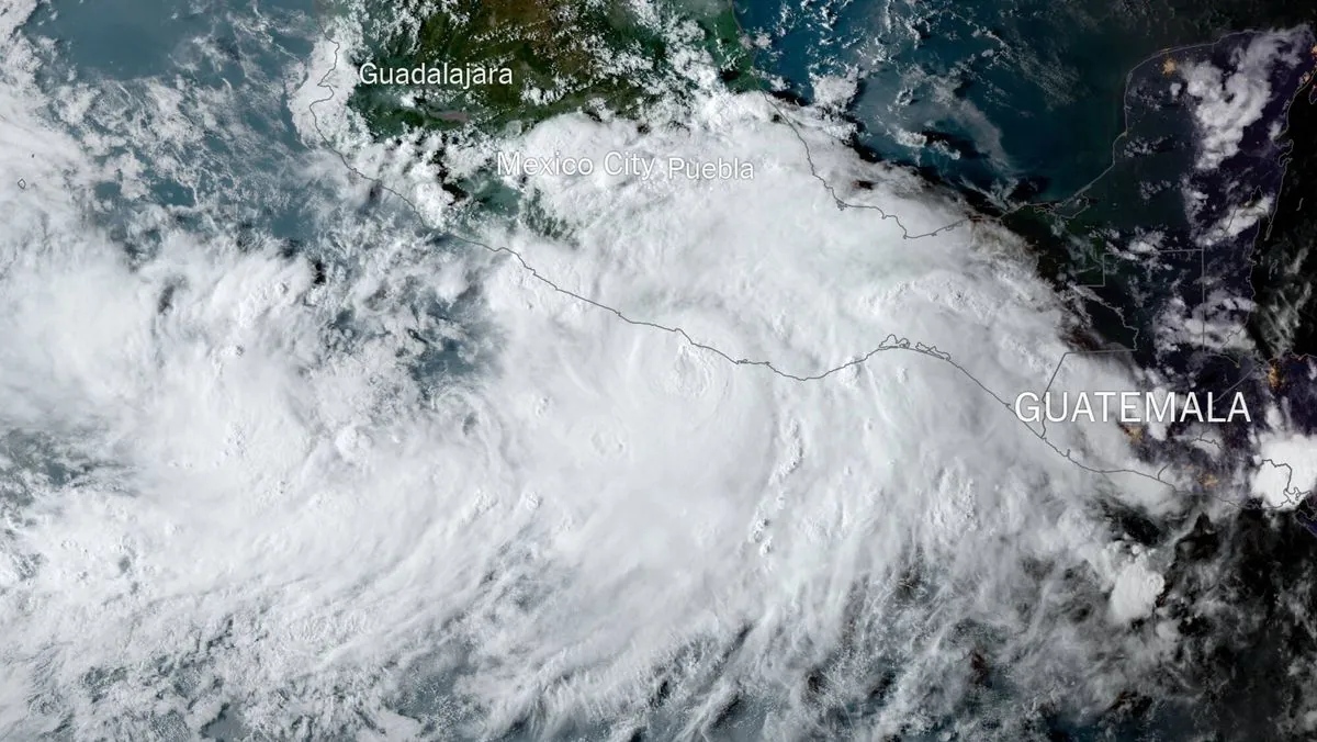
Tropical Storm John made landfall on Mexico's Pacific coast on September 23, 2024. Initially a Category 3 hurricane, John rapidly intensified before striking near Punta Maldonado. The storm's swift development echoes the behavior of Hurricane Michael in 2018, which was the first Category 5 hurricane to hit the contiguous United States since Andrew in 1992.
John's impact has been severe, with two fatalities reported in the coastal state of Guerrero. The victims perished when a mudslide crashed into their home in the remote mountain area of Tlacoachistlahuaca. This tragic event underscores the dangers posed by hurricanes beyond their immediate coastal impact, as they can trigger deadly landslides and flooding inland.
Meanwhile, a cluster of thunderstorms in the Caribbean Sea is poised to become Tropical Storm Helene, with forecasts suggesting it could strengthen into a major hurricane. This potential development has put several regions on high alert, including Florida's Tampa Bay area, parts of eastern Mexico, and Cuba's Pinar del Rio province.
The National Hurricane Center, established in 1965, is closely monitoring the situation. Lisa Bucci, a hurricane specialist at the center, emphasized the importance of early preparation: "Now is the time to start preparing. If you're in an evacuation zone, you should evacuate. Don't be fooled by the way the storm looks at the moment. We are expecting it to rapidly intensify."
In response to the looming threat, Florida Governor Ron DeSantis has declared a state of emergency in 61 of the state's 67 counties. This proactive measure aims to ensure readiness across a broad swath of the state, from the rural Panhandle region down to southwest Florida.
"We're anticipating impacts, I mean, 100, 200 miles (161 to 322 kilometers) outside the eye of the storm, you could see with winds and you could see with surge. We are going to see significant impacts no matter what happens."
The governor's concerns are well-founded, given Florida's history with hurricanes. Since 1851, the state has experienced 120 hurricanes, highlighting its vulnerability to these powerful storms.
As both weather systems continue to evolve, residents in affected areas are urged to stay informed and prepared. The National Hurricane Center advises having enough food and water for at least three days and being ready for potential power outages.
It's worth noting that hurricanes are immense energy systems, releasing heat at a rate of 50 trillion to 200 trillion watts. This power, combined with their potential for rapid intensification, makes them particularly dangerous and unpredictable.
As we monitor these developing storms, it's crucial to remember the lessons learned from past hurricanes. The 1900 Galveston hurricane, the deadliest in U.S. history, claimed 8,000-12,000 lives, while Hurricane Katrina in 2005 caused a staggering $125 billion in damage.
With the potential for Hurricane Helene to form and approach the Gulf Coast, residents and authorities alike must remain vigilant. The coming days will be critical as these weather systems continue to develop and move, potentially impacting millions of people across the region.


