


Great Lakes Mapping Project Aims to Unveil Underwater Secrets by 2030
A ambitious initiative to map the Great Lakes' bottom seeks to reveal shipwrecks, improve navigation, and aid climate modeling. The project faces funding challenges but continues to progress towards its 2030 goal.
The Great Lakes, containing 21% of the world's surface fresh water by volume, are set to reveal their hidden depths through an ambitious mapping project. Jennifer Boehme, executive director of the Great Lakes Observing System, is spearheading a campaign to chart every meter of the lakes' bottom by 2030. This initiative aims to uncover hundreds of underwater shipwrecks, illuminate topographical features, and locate crucial infrastructure.
The project's significance extends beyond mere exploration. High-resolution maps would enhance ship navigation, identify fisheries, and inform climate change models for erosion, storm surge, and flooding. Boehme emphasizes the discovery aspect, noting, "We know more about the surface of the moon than we do about the Great Lakes' bottom."
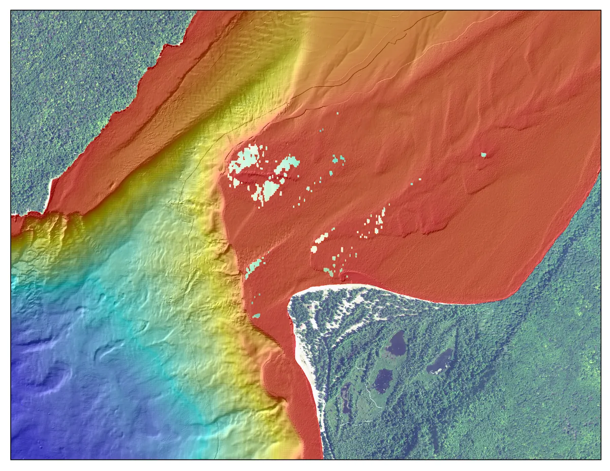
Currently, only a fraction of the Great Lakes' bottom has been mapped, with existing low-resolution charts dating back to the 1970s. The Great Lakes Observing System, a non-profit certified by NOAA in 2016, manages data from a network of lake observers. The organization has been advocating for comprehensive mapping since 2018, facing the challenge of covering an area larger than Kansas, with depths ranging from 210 feet in Lake Erie to over 1,300 feet in parts of Lake Superior.
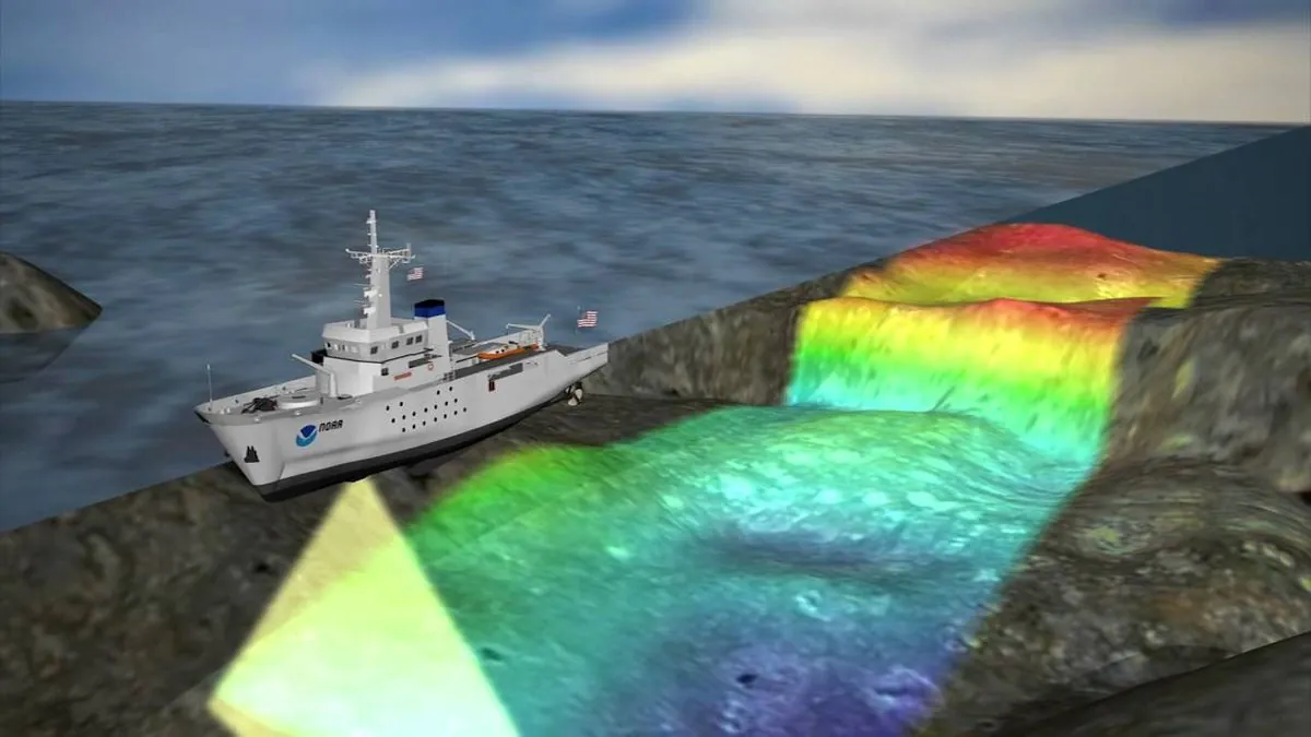
Technological advancements have made this ambitious project more feasible. Multibeam sonar and laser imaging are among the new tools available to create detailed, three-dimensional images of the lakebed. These technologies offer significant improvements over the single-beam sonar used in the 1970s, which covered only about 15% of mostly coastal lake bottom.
The benefits of a high-resolution map are numerous. It would provide updated depth findings for safer navigation, crucial information for climate change modeling, and precise locations of infrastructure such as pipelines. Additionally, the map could reveal the locations of hundreds of shipwrecks, with estimates suggesting around 6,000 wrecks in the Great Lakes.
"A high-resolution map of the lakebed would offer multiple benefits. It would provide fuller images of bottom features that have changed in the last 50 years due to erosion and shifting sands, giving navigators new depth findings that would improve shipping safety."
Despite growing support, the project faces funding challenges. A bill introduced by Michigan Representatives Lisa McClain and Debbie Dingell proposes allocating $200 million for the mapping effort. However, progress in Congress has been slow, with some lawmakers calling for a clearer articulation of the project's value.
Undeterred by potential election year delays, the Great Lakes Observing System continues to work towards its 2030 mapping goal. The organization holds annual conferences to discuss progress and test mapping technology, while also engaging boaters to contribute to the mapping effort.
As the project moves forward, it promises to unlock the secrets of a region that has been inhabited since ancient times and played a crucial role in North American history. From the first European exploration by Étienne Brûlé in 1615 to the development of the Great Lakes-Saint Lawrence Seaway system, these inland seas have been vital for transportation and commerce for centuries.
The mapping initiative not only aims to improve our understanding of the lakes' physical characteristics but also to support the $7 billion fishing industry and help protect the over 3,500 species of plants and animals that call the Great Lakes home. As climate change continues to impact water levels and ecosystems, this comprehensive mapping effort could prove invaluable for conservation and management strategies in the years to come.