


Hurricane Gilma Forms in Eastern Pacific, Poses No Immediate Threat to Land
Hurricane Gilma, the second of the eastern Pacific season, has formed far from land. The Category 1 storm is moving westward with no coastal warnings in effect, as forecasters predict further strengthening.
The eastern Pacific Ocean has witnessed the formation of its second hurricane of the season, named Gilma. As of early Wednesday, August 16, 2023, the storm achieved hurricane status, marking a significant meteorological event in the region.
Gilma is currently classified as a Category 1 hurricane on the Saffir-Simpson Hurricane Wind Scale, which categorizes hurricanes from 1 to 5 based on sustained wind speeds. The National Hurricane Center (NHC) in Miami, which monitors tropical cyclones in both the Atlantic and eastern Pacific basins, reported that Gilma was located approximately 935 miles (1,504 kilometers) west-southwest of the southern tip of Mexico's Baja California peninsula.
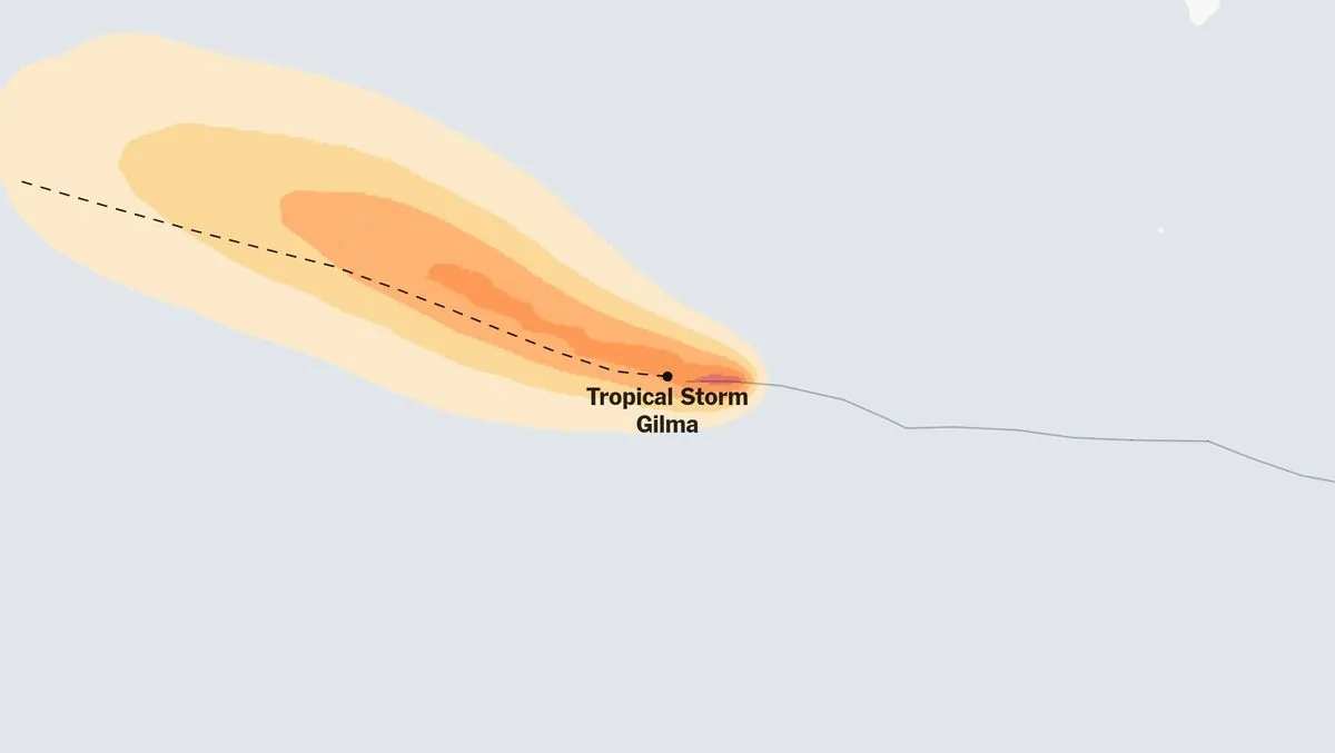
The hurricane's position far from land means there are currently no coastal watches or warnings in effect. This is reassuring news for coastal communities, as hurricanes can cause storm surges, heavy rainfall, and inland flooding even when not making direct landfall.
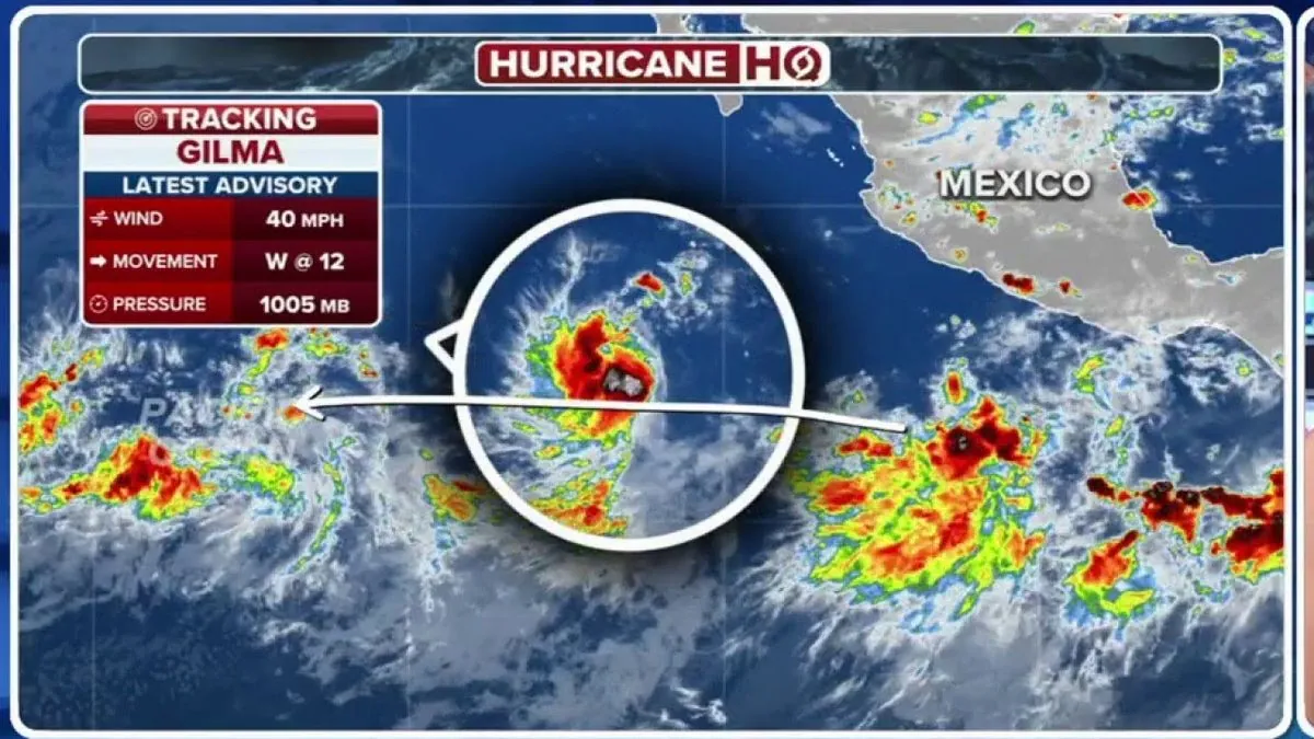
Gilma's journey began earlier, strengthening to tropical storm status on Sunday, August 13, 2023. The storm is now moving westward at a speed of 10 mph (16 kph), with forecasts suggesting a slightly slower westward to west-northwest motion in the coming days. Meteorologists anticipate further strengthening during this period.
The hurricane's current maximum sustained winds are near 75 mph (120 kph), with higher gusts. Hurricane-force winds, defined as winds of 74 mph (119 km/h) or higher, extend outward up to 25 miles (40 km) from the center. Additionally, tropical-storm-force winds reach out to 140 miles (225 km) from the storm's core.
It's worth noting that the eastern Pacific hurricane season officially runs from May 15 to November 30, with an average of about 15 named storms per year. Gilma follows Hurricane Adrian, which formed in late June, as the second hurricane of the 2023 season in this basin.
"There are no coastal watches or warnings in effect. A slightly slower westward to west-northwest motion was expected during the next few days and additional strengthening is forecast during that time."
The formation and tracking of Gilma highlight the crucial role of satellite technology in monitoring and forecasting hurricane movements. This technology, combined with the expertise of meteorologists at centers like the NHC, provides valuable information for public safety and preparedness.
While Gilma currently poses no immediate threat to land, it serves as a reminder of the power and unpredictability of these natural phenomena. As climate change continues to influence weather patterns, scientists expect an increase in hurricane intensity, though not necessarily in frequency.
As we observe Gilma's development, it's important to remember that the eastern Pacific basin is historically the second most active for tropical cyclones after the western Pacific. With El Niño conditions potentially leading to increased hurricane activity in the eastern Pacific, vigilance and preparedness remain key for coastal communities throughout the season.