


Tropical Storm Helene Intensifies, Threatens Florida with Major Hurricane Impact
Tropical Storm Helene strengthens in the Gulf of Mexico, prompting evacuations and warnings across Florida. Officials urge residents to prepare for potential Category 3 hurricane landfall within 48 hours.
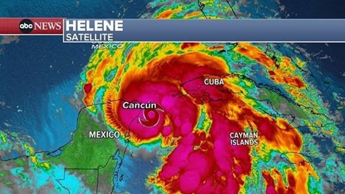
As of September 25, 2024, Tropical Storm Helene is rapidly intensifying in the eastern Gulf of Mexico, the ninth largest body of water globally. Meteorologists anticipate Helene's transformation into a hurricane by September 26, posing a significant threat to Florida's coastline.
The National Hurricane Center, established in 1965, has issued warnings affecting over 40 million residents across Florida, Georgia, and Alabama. These alerts highlight the storm's potential to bring life-threatening conditions to the region within 48 hours.
Local authorities have initiated evacuations along Florida's Gulf coast, including Sarasota and Charlotte counties. Educational institutions in numerous counties, such as Hillsborough and Pinellas, have announced closures. Pinellas County officials have ordered the relocation of vulnerable populations from coastal healthcare facilities.
Governor Ron DeSantis addressed the public on September 24, emphasizing the urgency of the situation:
"Now, you still have time to prepare, review your hurricane plan, and make sure that you are executing your hurricane preparedness plan."
Helene's wind speeds have reached 70 mph (160 kph), approaching hurricane force. The storm is expected to strengthen rapidly over the warm Gulf waters, potentially becoming a major hurricane by September 28. The Saffir-Simpson Hurricane Wind Scale, developed in 1971, classifies major hurricanes as Category 3 or higher, capable of causing devastating damage.
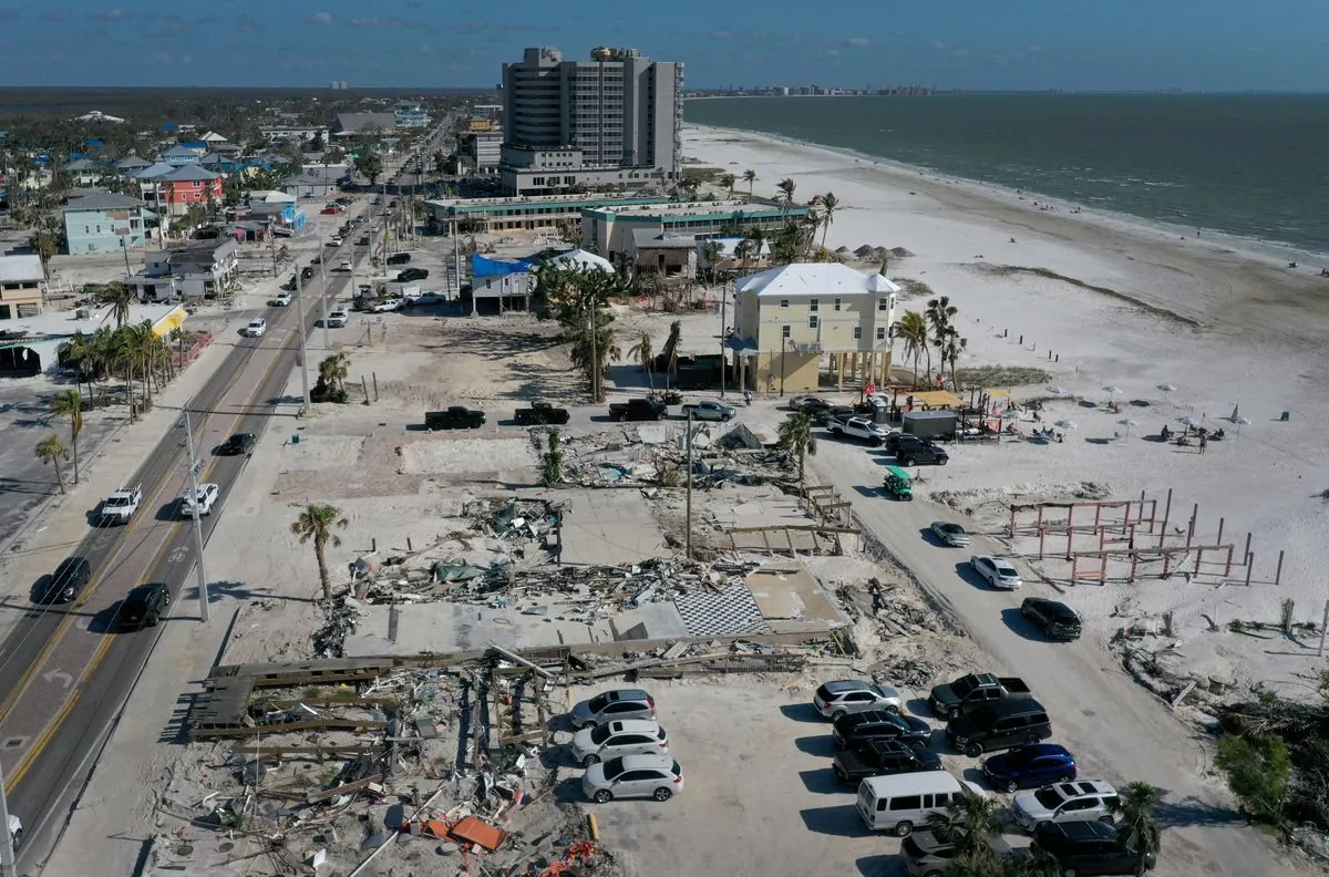
Forecasters predict Helene could reach Category 3 status before making landfall on Florida's Big Bend region, an area known for its extensive wetlands and wildlife. This region, south of Tallahassee, may face storm surges up to 15 feet (4.6 m) and isolated rainfall totals of 15 inches (38.1 cm), raising concerns about flash and urban flooding.
The National Flood Insurance Program, created in response to hurricane damage, may face significant claims if predictions materialize. Residents in Helene's path are advised to prepare for potential power outages lasting up to a week.
It's worth noting that Florida has been impacted by more hurricanes than any other U.S. state. The Atlantic hurricane season, which officially runs from June 1 to November 30, has seen increased activity in recent years. Climate change is expected to further intensify hurricane strength in the future.
As Helene approaches, hurricane hunters are likely to fly into the storm, gathering crucial data for accurate forecasts. This practice, along with satellite imagery first captured in 1960, has significantly improved hurricane tracking and prediction.
The term "hurricane" itself has historical roots, derived from the indigenous Taino people's word "hurakán." These powerful storms, which rotate counterclockwise in the Northern Hemisphere, can have eyes typically 20-40 miles in diameter.
As Helene continues its path, residents are reminded that a hurricane's impacts can extend hundreds of miles from its center. The memory of Hurricane Katrina in 2005, the costliest hurricane in U.S. history, serves as a stark reminder of the potential devastation these storms can cause.
Authorities stress the importance of following evacuation orders and staying informed through official channels as the situation develops. The coming days will be crucial as Helene approaches the Florida coast, potentially marking another significant event in the state's long history with hurricanes.