
This story appears on RNZ.co.nz
Northland may cop squally showers, thunderstorms and potentially “damaging” wind gusts and tornadoes of more than 110kmh on Friday evening, as an active front is forecast to hit the region.
MetService has issued a severe thunderstorm watch for the region from 8pm to midnight.
It is warning that wind gusts of this strength can cause some structural damage, including to trees and power lines, and may make driving hazardous, the weather forecaster says.
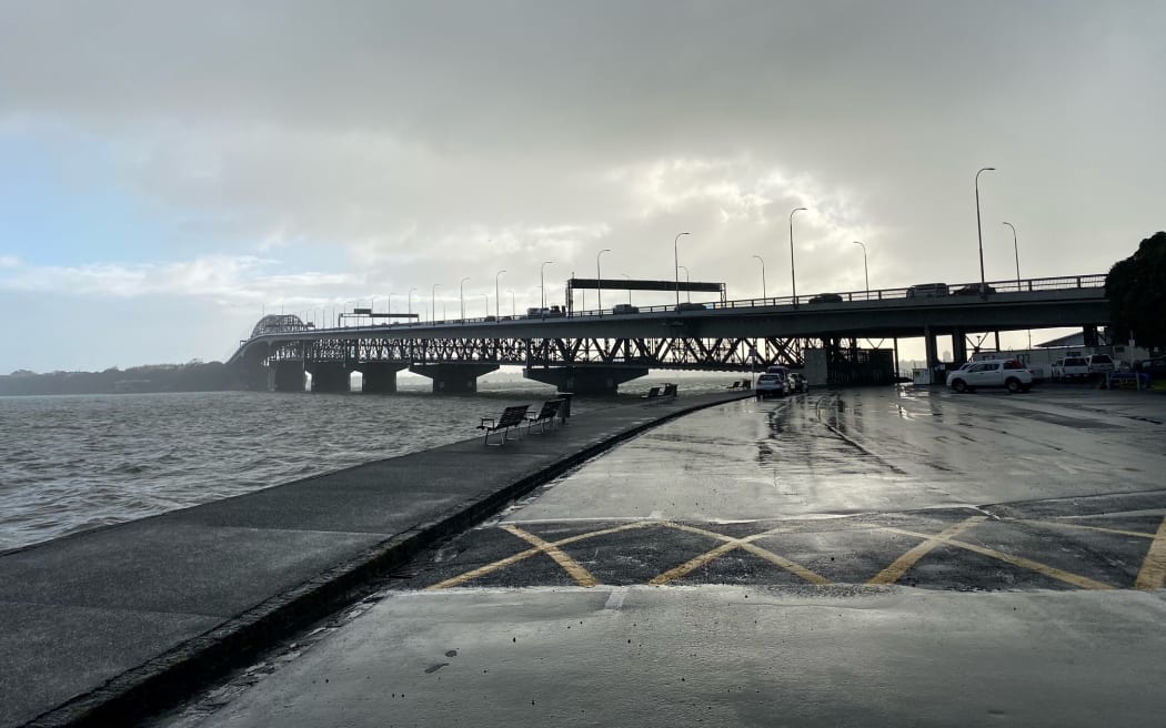
Meanwhile, there’s a risk that thunderstorms, tornadoes, heavy showers and hail could also hit Tāmaki Makaurau (Auckland) today, with speed being reduced on the Auckland Harbour Bridge amid an amber alert for high winds during peak-hour traffic.
“It’s quite showery and windy across Auckland, and this evening the thunderstorms could possibly be severe. It’s a good idea to keep an eye on updates,” MetService meteorologist Kathryn Hodge said.
A strong wind watch has also been issued for Northland between 8pm and midnight.
At about 6pm, both Auckland and Northland have a risk of “small tornadoes” as an unsettled southwesterly flow moves through the area.
In Northland, if any tornadoes occur, they will only affect “very localised” areas, MetService said.
“Strong winds and showering weather is going to be here for a few days to come,” Hodge said.
Looking ahead to the weekend, a strong wind watch has been issued for Hawke’s Bay, south of Hastings, and the Tararua District for nine hours, from 8pm on Saturday to 5am on Sunday.
MetService meteorologist Andrew James said we’re also in for a cold start to the weekend, with temperatures forecast in the single digits right across the country for 5am Saturday, and into the negatives in the south.
“Make sure you’ll be wrapping up,” he said.
The cold weather could also bring with it a “top up” of snow for Ruapehu and Mt Taranaki about 900m.
Weather impacts on the roads
An amber alert has been issued for Auckland Harbour Bridge, where speeds are reduced and some lanes on the bridge may close.
Waka Kotahi said high-sided vehicle drivers and motorcyclists should use the western ring route on State Highways 16 and 18.
Another amber alert is likely on Saturday morning, with a low risk of brief periods of a red alert.
From Sunday morning, gusts of 75 to 80kmh are still likely, especially with passing showers, Waka Kotahi said.
Heavy snow watches are also in place for Fiordland, from 9am Saturday to 1am Monday, and in parts of Otago, Southland and Stewart Island, from 2pm Saturday to 5am Monday.
Snow is expected to fall down to 100m at times.
Further north, SH1 Dome Valley remains closed for the fourth morning in a row, following a major slip where 30 truckloads of rocks and debris scattered onto the road.
At 7.20am Waka Kotahi said the SH1, between Wellsford and Warkworth, will remain closed on Friday “until further notice”.
Drivers should take alternative routes through SH16, Waka Kotahi said.
*This story was first published by Stuff
