Potential Major Hurricane Threatens Gulf Coast, Cuba, and Mexico
A cluster of storms near the Cayman Islands is expected to intensify into Hurricane Helene, prompting watches for Cuba and Mexico. Forecasters warn of potential Category 3 strength as it approaches the U.S. Gulf Coast.

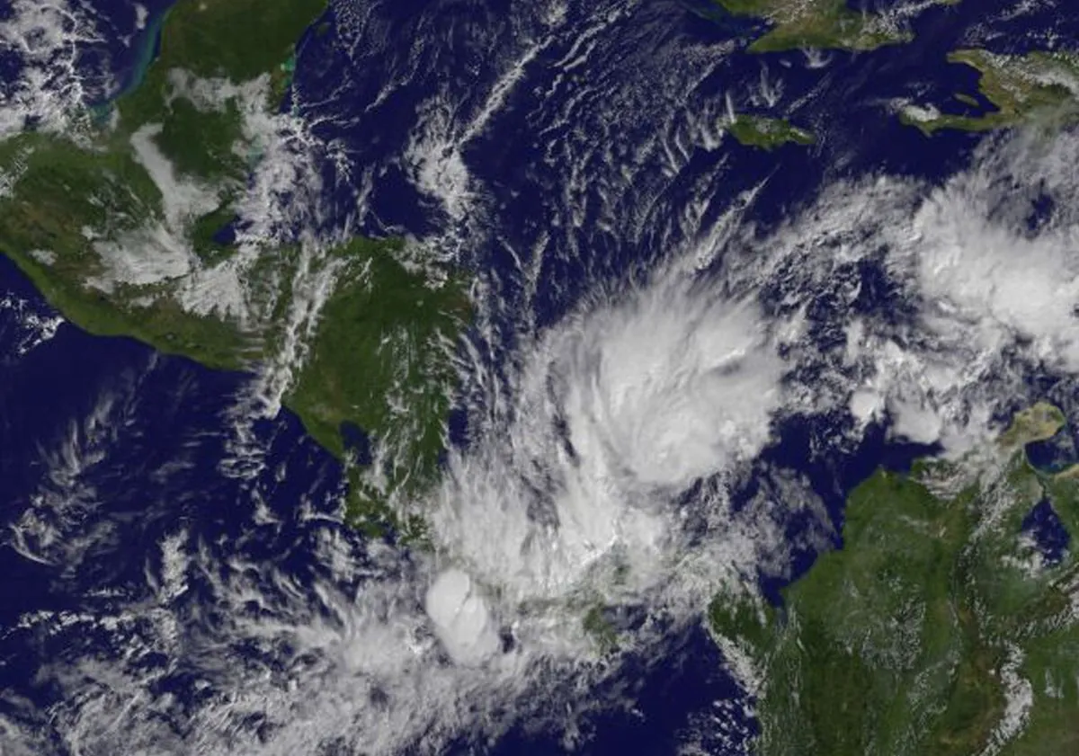
A cluster of storms located south of the Cayman Islands is forecasted to develop into a significant hurricane, prompting weather authorities to issue hurricane watches for parts of Cuba and Mexico. The disturbance, expected to become Hurricane Helene by September 25, 2024, is projected to strengthen into a major hurricane as it moves northward towards the United States Gulf Coast.
The National Hurricane Center reports that the system could reach Category 3 or higher intensity when it approaches the northeastern Gulf Coast on September 26, 2024. Michael Lowry, a hurricane specialist and storm surge expert, suggests that parts of north Florida or its Big Bend region may face a substantial threat before the end of the week.
As of September 23, 2024, the disturbance was situated approximately 205 kilometers south-southwest of Grand Cayman, with maximum sustained winds of 45 km/h and moving north at 9 km/h. The Saffir-Simpson Hurricane Wind Scale classifies a Category 3 hurricane as having sustained winds of 111-129 mph, capable of causing devastating damage.

Hurricane watches have been issued for Cuba's Pinar del Río province and eastern Mexico from Cabo Catoche to Tulum. Tropical storm warnings are in effect for eastern Mexico from Río Lagartos to Tulum and for the Cuban provinces of Artemisa, Pinar del Río, and the Isle of Youth. Pinar del Río, known for its tobacco production, may face significant agricultural impacts.
Meteorologists predict substantial rainfall, with western Cuba and the Cayman Islands potentially receiving up to 20 centimeters, and isolated areas up to 30 centimeters. The eastern Yucatán Peninsula could see up to 10 centimeters, with some locations experiencing over 15 centimeters. Heavy rainfall is also anticipated for the southeastern United States starting September 25, 2024, raising concerns about flash and river flooding.
Storm surge, an abnormal rise of water generated by a storm's winds, is forecast to reach up to 1.2 meters in parts of Cuba and Mexico. The Yucatán Peninsula, home to numerous Mayan archaeological sites, may face both flooding and wind damage.
In response to the impending weather system, authorities in the Cayman Islands have closed schools due to the risk of severe flooding. The Cayman Islands, a British Overseas Territory comprising Grand Cayman, Cayman Brac, and Little Cayman, are particularly vulnerable to tropical systems.
If formed, Helene would become the eighth named storm of the 2024 Atlantic hurricane season, which runs from June 1 to November 30. The National Oceanic and Atmospheric Administration (NOAA) has predicted an above-average season due to record-warm ocean temperatures, forecasting 17 to 25 named storms, including four to seven major hurricanes of Category 3 or higher.
The Gulf Stream, a powerful ocean current in the Atlantic, plays a crucial role in influencing hurricane paths and intensities. Additionally, phenomena such as El Niño and La Niña can affect hurricane formation and strength throughout the season.
As the situation develops, hurricane hunters, specialized aircraft that fly into tropical cyclones, will likely be deployed to gather critical data about the storm's structure and intensity. This information is vital for accurate forecasting and public safety preparations.
Residents and visitors in potentially affected areas are advised to stay informed about the storm's progress and follow local authorities' instructions. The eye of a hurricane, while deceptively calm, is surrounded by the most intense part of the storm, emphasizing the importance of remaining vigilant throughout the entire weather event.


