


Rare August Snow Dusts Western U.S. Mountains Amid Fire Risks
Unusual cold front brings snow to Mount Rainier and Sierra Nevada in August, a rare event not seen since 2003. Concurrent fire dangers and flood warnings highlight complex weather patterns affecting the region.
An unexpected cold front has brought a rare August snowfall to parts of the western United States, creating a stark contrast with ongoing fire risks and flood warnings in the region. The unusual weather event, originating from the Gulf of Alaska, has impacted areas from Washington state to California's Sierra Nevada.
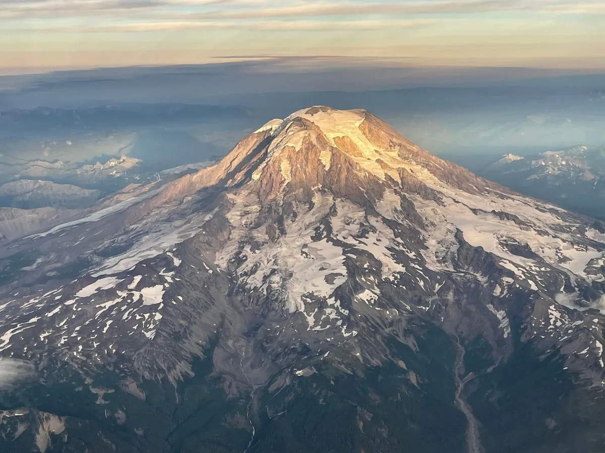
Mount Rainier, Washington's highest peak at 14,411 feet, received a dusting of snow, as evidenced by a photograph shared by the National Weather Service. This cold system, moving southward through the Pacific Northwest into Northern California, interrupted the typical summer weather patterns of the West Coast.
In California, the National Weather Service forecasted light snow possibility for higher elevations of Yosemite National Park and around Tioga Pass. At 9,943 feet, Tioga Pass serves as the eastern gateway to Yosemite and is the highest highway pass in California. August snowfall in these locations hasn't occurred since 2003, marking this event as particularly noteworthy.
While the snow is not expected to linger, authorities have warned that roads near Tioga Pass could become slippery. Campers and hikers in the area have been advised to prepare for winter conditions, an unusual precaution for August in California.
The ski industry, despite being months away from its regular season, welcomed this hint of winter. Palisades Tahoe, the resort that hosted the 1960 Winter Olympics, expressed excitement about the possibility of their first snowfall of the season.
"It's a cool and blustery August day here at Palisades Tahoe, as a storm that could bring our first snowfall of the season moves in this afternoon!"
The National Weather Service's Weather Prediction Center, established in 1995, predicted that these "anomalous cool conditions" would spread across much of the western U.S. by the following day. However, the weather service also cautioned about fire dangers due to gusty winds associated with the cold front's passage.
Simultaneously, a flash flood watch was issued for the burn scar of California's largest wildfire of the year. The Park Fire, which began in late July near Chico, had consumed over 671 square miles, becoming California's fourth-largest fire on record. While the fire has been largely contained, the burn scar remains vulnerable to erosion and flooding, a common issue in areas affected by wildfires.
This complex weather scenario follows an intense start to California's wildfire season, fueled by extreme July heat and dried-out vegetation from previous wet years. The state's largest recorded wildfire, the August Complex fire of 2020, burned over 1 million acres, highlighting the increasing severity of wildfires in recent years.
As the cold front departs, forecasts predict a rapid return to summer heat. This quick transition underscores the dynamic and sometimes unpredictable nature of weather patterns in the western United States, particularly in the context of climate change, which has been linked to an increase in extreme weather events.