


Southeast Coast on Alert: Tropical Storm Warning Issued
National Hurricane Center warns of potential flooding and high surf along Carolinas' coast. Tropical disturbance off Charleston poses risks to coastal areas from South Carolina to North Carolina's Outer Banks.
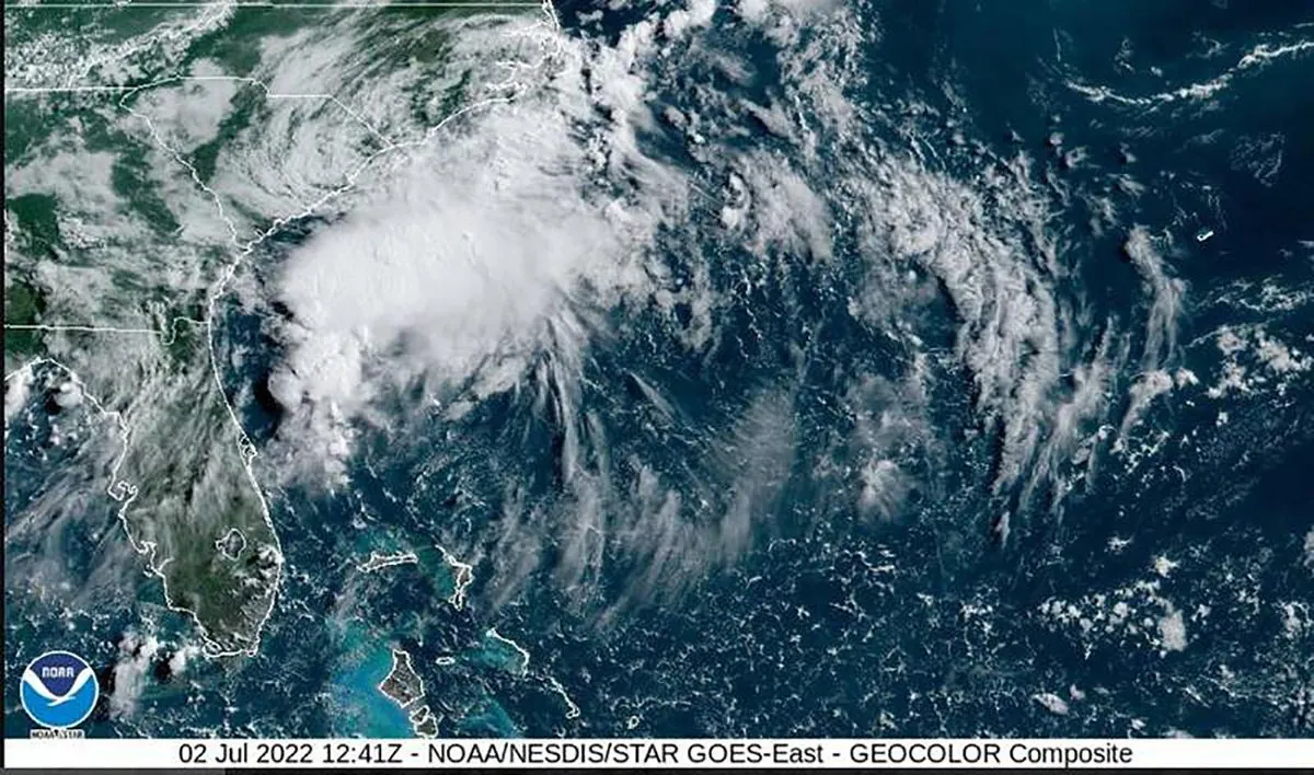
The National Hurricane Center has issued a tropical storm warning for portions of the Southeast United States coastline, highlighting the potential for significant weather impacts. This development comes as a tropical disturbance emerges off the Carolinas, prompting concerns about heavy rainfall and coastal flooding.
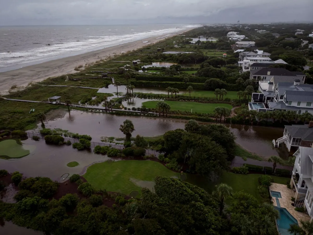
The warning area extends from Edisto Beach, South Carolina, northward to Ocracoke Inlet, situated at the southern tip of North Carolina's Outer Banks. This 200-mile-long string of barrier islands is known for its vulnerability to coastal storms and flooding events.
As of 5 p.m. EDT on September 15, 2024, the center of the disturbance was located approximately 125 miles (200 kilometers) east-southeast of Charleston, South Carolina. The system is characterized by maximum sustained winds of 45 mph (75 kph) and is moving northwest towards the coast at a speed of 7 mph (11 kph).
Meteorologists at the National Hurricane Center, a component of the National Centers for Environmental Prediction, are closely monitoring the situation. They warn of several potential hazards associated with this weather system:
- Urban and flash flooding
- Minor river flooding
- High surf conditions along the Southeast coast
It's important to note that flash floods can develop rapidly, sometimes within minutes or hours of excessive rainfall. Urban areas are particularly susceptible to flooding when drainage systems become overwhelmed by intense precipitation.
The Atlantic hurricane season, which officially runs from June 1 to November 30, has seen its share of impactful storms in the past. The Carolinas have a history of significant hurricane events, including the devastating Hurricane Hugo in 1989.
Residents and visitors in the affected areas should stay informed about the latest weather updates and follow guidance from local authorities. The National Weather Service issues various types of watches and warnings for severe weather events to help communities prepare and respond appropriately.
As this tropical system approaches, it's worth noting that tropical cyclones in the Northern Hemisphere rotate counterclockwise due to the Coriolis effect. This phenomenon influences the storm's structure and movement patterns.
While the current wind speeds of 45 mph classify this system as a tropical storm, it's essential to remember that the Saffir-Simpson Hurricane Wind Scale categorizes more intense systems into five categories based on sustained wind speeds. Regardless of classification, all tropical systems can pose significant risks to coastal and inland areas.
"The area of bad weather was centered about 125 miles (200 kilometers) east-southeast of Charleston, South Carolina. It has maximum sustained winds of 45 mph (75 kph) and is moving to the northwest toward the coast at 7 mph (11 kph)."
As the situation evolves, coastal communities from the historic city of Charleston, South Carolina, founded in 1670, to the picturesque Edisto Beach and the remote Ocracoke Inlet should remain vigilant and prepared for potential impacts.