


Hurricane John Intensifies, Threatens Mexico's Southwest Coast
Hurricane John strengthens near Mexico's coast, causing flooding and mudslides. Experts warn of "zombie" storm behavior and link warm sea temperatures to increased hurricane intensity.
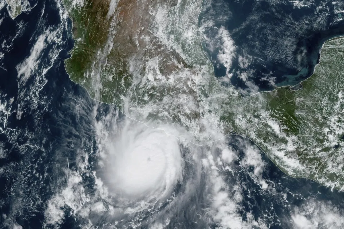
Hurricane John has intensified once again, posing a significant threat to Mexico's southwestern coastline. The storm, which has been affecting the region since Monday, September 23, 2024, has brought heavy rainfall to areas already saturated by its slow-moving nature.
The hurricane's behavior has led meteorologists to classify it as a "zombie" storm, a term first coined by the U.S. National Weather Service in 2020. This phenomenon refers to storm systems that dissipate before regaining strength, as observed with Hurricane Paulette near the Azores that year.
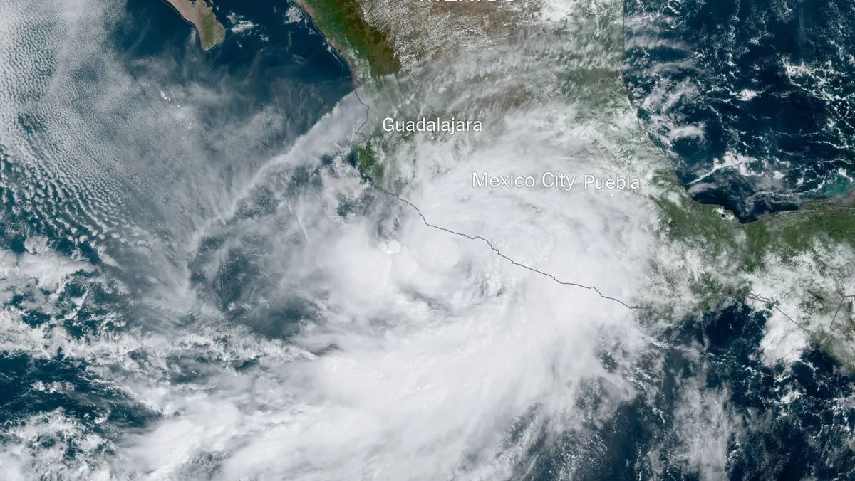
John's slow movement and lack of large-scale steering forces have made it particularly dangerous. Christopher Rozoff, an atmospheric scientist at the National Center for Atmospheric Research, explained that this characteristic makes the storm "prone to take a disastrous path back over sea to reintensify and further torment the Mexican coast with extreme rainfall."
The hurricane has significantly impacted the state of Guerrero, uprooting trees, causing power outages, and triggering deadly landslides. Evelyn Salgado, the Governor of Guerrero, has urged residents to take all necessary precautions. The popular resort area of Acapulco, still recovering from the destruction caused by Hurricane Otis in 2023, has experienced flooding and damage to beachfront establishments.
As of September 26, 2024, Hurricane John was located 55 miles (89 km) southwest of Lazaro Cardenas, one of Mexico's largest commercial ports. The U.S. National Hurricane Center expects the storm to skirt Mexico's southwest coast, affecting the states of Michoacan, Guerrero, and Oaxaca through at least Saturday, September 28, 2024.
The warm sea temperatures in the region have played a crucial role in John's behavior. Alex DaSilva, AccuWeather's lead hurricane expert, noted that areas where John developed had water temperatures nearing 32 degrees Celsius (90 degrees Fahrenheit), providing ample fuel for the storm. This phenomenon is not unique to John; Hurricane Otis in 2023 also experienced rapid intensification due to similar conditions.
The impact of climate change on hurricane patterns is becoming increasingly evident. Andra Garner, a meteorologist at Rowan University, suggested that warmer waters likely contributed to John's reformation after its initial landfall. DaSilva added that future scenarios with higher sea surface temperatures could lead to more frequent episodes of rapid intensification.
It's worth noting that hurricanes are complex weather systems influenced by various factors. The Saffir-Simpson Hurricane Wind Scale categorizes these storms from 1 to 5 based on sustained wind speeds. While wind is a significant concern, storm surge often poses the greatest threat to life and property during hurricanes.
As Hurricane John continues to affect Mexico's Pacific coast, which is part of the geologically active "Ring of Fire," authorities and residents must remain vigilant. The National Hurricane Center, established in 1965, plays a crucial role in tracking and forecasting these dangerous weather events, utilizing advanced technologies that have evolved significantly since the launch of the first weather satellite, TIROS-1, in 1960.
"This heavy rainfall will likely cause significant and catastrophic life-threatening flash flooding and mudslides."
The situation serves as a reminder of the destructive potential of hurricanes, recalling the devastating impact of Hurricane Ivan in 2004, which caused approximately $26 billion in damages. As climate patterns continue to evolve, understanding and preparing for these powerful storms becomes increasingly critical for coastal communities worldwide.